NAME
m.cdo.download - Downloads data from NCEI's Climate Data Online (CDO) using their v2 API.KEYWORDS
NOAA, NCEI, Climate Data Online, CDOSYNOPSIS
Flags:
- -c
- Do not include column names in output
- -j
- Print output in JSON
- -u
- Print the request URL and exit
- --overwrite
- Allow output files to overwrite existing files
- --help
- Print usage summary
- --verbose
- Verbose module output
- --quiet
- Quiet module output
- --ui
- Force launching GUI dialog
Parameters:
- fetch=string [required]
- Fetch available metadata or actual data for this specific item
- Options: datasets, datacategories, datatypes, locationcategories, locations, stations, data
- Default: data
- datasetid=string[,string,...]
- Dataset ID
- datacategoryid=string[,string,...]
- Data category ID
- datatypeid=string[,string,...]
- Data type ID
- locationcategoryid=string[,string,...]
- Location category ID
- locationid=string[,string,...]
- Location ID
- stationid=string[,string,...]
- Station ID
- startdate=string
- Start date in YYYY-MM-DD or date time in YYYY-MM-DDThh:mm:ss (for data only)
- enddate=string
- End date in YYYY-MM-DD or date time in YYYY-MM-DDThh:mm:ss (for data only)
- extent=east,north[,east,north,...]
- Extent in lower-left and upper-right coordinates in degrees
- units=string
- Units for data (raw for no conversion)
- Options: raw, standard, metric
- Default: metric
- includemetadata=string
- Include metadata when actually fetching data (slower)
- Options: true, false
- Default: false
- sortfield=string
- Sort field
- Options: id, name, mindate, maxdate, datacoverage
- sortorder=string
- Sort order
- Options: asc, desc
- Default: asc
- limit=integer
- Max number of results (0 for unlimited; can be > 1000)
- Default: 0
- offset=integer
- 1-based offset for the first result
- Default: 1
- fields=string[,string,...]
- Fields to print
- separator=character
- Field separator
- Special characters: pipe, comma, space, tab, newline
- Default: pipe
- indent=integer
- Indent for JSON format (-1 for single line per record)
- Default: 2
- output=name
- Name for output file
Table of contents
DESCRIPTION
m.cdo.download downloads data from NCEI's Climate Data Online (CDO) using their v2 API.NOTES
This module uses the CDO Web Services v2 API to download CDO data.To access the API services, obtain CDO API tokens from here and define an environment variable CDO_API_TOKENS. Use commas to separate multiple tokens. For example, two tokens can be stored as follows:
export CDO_API_TOKENS=aaaaaaaaaaaaaaaaaaaaaaaaaaaaaaaa,bbbbbbbbbbbbbbbbbbbbbbbbbbbbbbbb
EXAMPLES
List available datasets:
m.cdo.download fetch=datasets
List available dataset IDs without column names:
m.cdo.download -c fetch=datasets fields=id
List available stations within (47.5204,-122.2047)-(47.6139,-122.1065):
m.cdo.download fetch=stations extent=47.5204,-122.2047,47.6139,-122.1065
List available "precipitation" and "average temperature" data types:
m.cdo.download fetch=datatypes field=id,mindate,maxdate,name |
grep -i "|precipitation\||average temperature"
List 10 available stations with PRCP and TAVG data starting 2023-01-01:
m.cdo.download fetch=stations datatypeid=PRCP,TAVG startdate=2023-01-01 limit=10
Fetch daily PRCP and TAVG data for a station with mindate ≤ 2023-01-01 and save it into a file:
# find dataset IDs for data types PRCP and TAVG; let's use GHCND (Daily Summary)
m.cdo.download fetch=datasets datatypeid=PRCP,TAVG

# find the first station ID with mindate ≤ 2023-01-01
stationid=$(m.cdo.download -c fetch=stations datatypeid=PRCP,TAVG \
	startdate=2023-01-01 fields=id limit=1)

# fetch actual data and save it to data.txt
m.cdo.download fetch=data datasetid=GHCND datatypeid=PRCP,TAVG \
	stationid=$stationid startdate=2023-01-01 enddate=2023-10-15 \
	output=data.txt
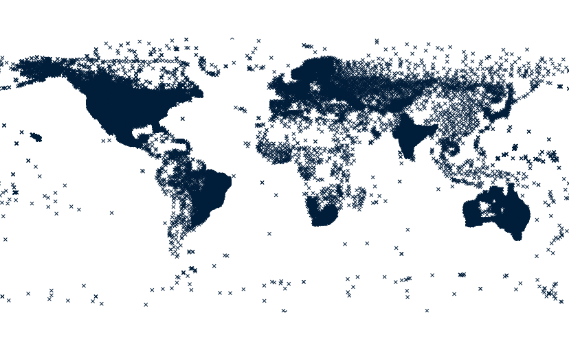
Create a point vector map with all stations:
# from a latlong location

# download metadata for all stations
m.cdo.download stations output=cdo_stations.txt

# import cdo_stations.txt
xy=$(awk -F'|' '{
	if (NR == 1) {
		for (i = 1; i <= NF; i++)
			if ($i == "latitude")
				latind = i
			else if ($i == "longitude")
				lonind = i
		printf "x=%s y=%s", lonind, latind
		exit
	}
}' cdo_stations.txt)
v.in.ascii input=cdo_stations.txt output=cdo_stations skip=1 $xy

# rename columns
old_cols=$(db.columns table=cdo_stations exclude=cat)
new_cols=$(head -1 cdo_stations.txt | sed 's/|/ /g')

for old_new in $(echo $old_cols $new_cols |
	awk '{
		n = NF / 2
		for (i = 1; i <= n; i++)
			printf "%s,%s\n", $i, $(i + n)
	}'); do
	v.db.renamecolumn map=cdo_stations column=$old_new
done
SEE ALSO
m.tnm.downloadAUTHOR
Huidae Cho, New Mexico State UniversitySOURCE CODE
Available at: m.cdo.download source code (history)
Latest change: Saturday Oct 21 23:02:07 2023 in commit: 31ae1cfa675745f06d887625deec87700bded733
Main index | Miscellaneous index | Topics index | Keywords index | Graphical index | Full index
© 2003-2024 GRASS Development Team, GRASS GIS 8.3.3dev Reference Manual