NAME
v.buffer - Creates a buffer around vector features of given type.KEYWORDS
vector, buffer, area, circle, geometry, line, grow, shrinkSYNOPSIS
Flags:
- -s
- Make outside corners straight
- -c
- Do not make caps at the ends of polylines
- -t
- Transfer categories and attributes
- --overwrite
- Allow output files to overwrite existing files
- --help
- Print usage summary
- --verbose
- Verbose module output
- --quiet
- Quiet module output
- --ui
- Force launching GUI dialog
Parameters:
- input=name [required]
- Name of input vector map
- Or data source for direct OGR access
- layer=string
- Layer number or name ('-1' for all layers)
- A single vector map can be connected to multiple database tables. This number determines which table to use. When used with direct OGR access this is the layer name.
- Default: -1
- cats=range
- Category values
- Example: 1,3,7-9,13
- where=sql_query
- WHERE conditions of SQL statement without 'where' keyword
- Example: income < 1000 and population >= 10000
- type=string[,string,...]
- Input feature type
- Options: point, line, boundary, centroid, area
- Default: point,line,area
- output=name [required]
- Name for output vector map
- distance=float
- Buffer distance along major axis in map units
- minordistance=float
- Buffer distance along minor axis in map units
- angle=float
- Angle of major axis in degrees
- Default: 0
- column=name
- Name of column to use for buffer distances
- scale=float
- Scaling factor for attribute column values
- Default: 1.0
- tolerance=float
- Maximum distance between theoretical arc and polygon segments as multiple of buffer (default 0.01)
Table of contents
DESCRIPTION
v.buffer creates a buffer around features of given type, which have a category in the given layer. The tolerance controls the number of vector segments being generated (the smaller the value, the more vector segments are generated).NOTES
Internal buffers for areas can be generated with negative distance values ("inward buffer" or "negative buffer" or "shrinking").v.buffer fusions the geometries of buffers by default. Categories and attribute table will not be transferred (this would not make sense as one buffer geometry can be the result of many different input geometries). To transfer the categories and attributes the user can set the t flag. This will result in buffers being cut up where buffers of individual input geometries overlap. Each part that is the result of overlapping buffers of multiple geometries will have multiple categories corresponding to those geometries, and multiple buffer areas can have the same category. The buffer for the input feature with category X can thus be retrieved by selecting all buffer areas with category X (see example below).
Buffers for lines and areas are generated using the algorithms from the GEOS library.
For advanced users: built-in buffer algorithm no longer desired, we use GEOS: If GRASS is not compiled with GEOS support or environmental variable GRASS_VECTOR_BUFFER is defined, then GRASS generates buffers using built-in buffering algorithm (which is still buggy for some input data).
The options minordistance, angle, tolerance are kept for backward compatibility and have no effect with GEOS buffering.
Corner settings
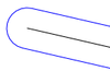
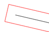
The following vector line related corners (also called "cap") exist:- no cap:
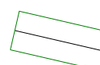
- rounded cap:
- square cap:
EXAMPLES
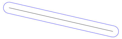
All examples are based on the North Carolina sample dataset.Buffer around input lines
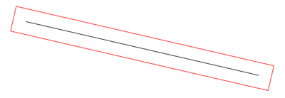
v.buffer input=roadsmajor output=roadsmajor_buffer type=line distance=100
Buffer of 100m along the "roadsmajor" lines (map subset, original center line shown in black)
Circles around input points
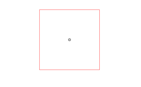
v.buffer input=hospitals output=hospitals_circled type=point distance=2000
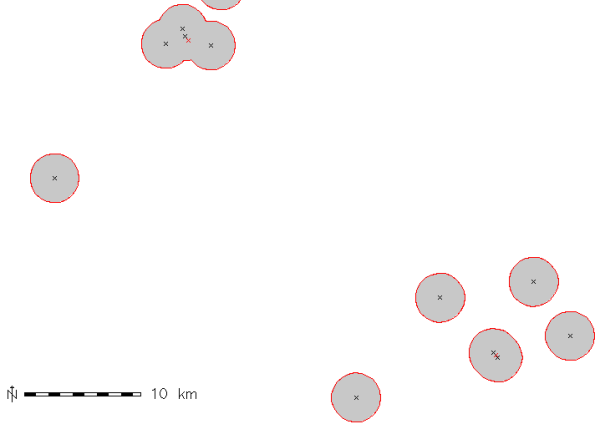
Buffer of 2000m around the "hospitals" points (map subset, original points shown in black, new area centroids in red)
Circles around input points with attribute transfer
v.buffer input=hospitals output=hospitals_circled type=point distance=1000 -t

# display buffer around hospital with category 36,
# this buffer is composed of several areas:
d.vect map=hospitals_circled type=area layer=1 cats=36
# extract this buffer, dissolving boundaries
v.extract in=hospitals_circled output=hospital_36_circled layer=1 cats=36 -d
Buffer around input areas
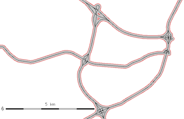
v.buffer input=lakes output=lakes_buffer type=area distance=100
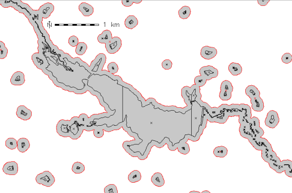
Buffer of 100m around the "lakes" polygons (map subset, original areas shown in black)
Buffer inside input areas
In this example, an internal buffer ("inward buffer" or "negative buffer") is generated using a negative distance value:v.buffer input=lakes output=lakes_buffer type=area distance=-50
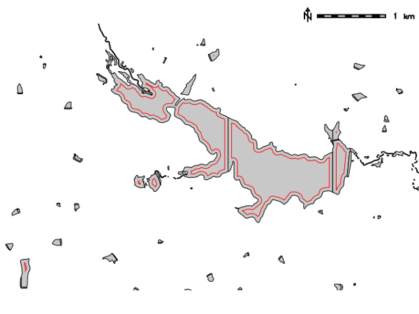
Internal buffer of 50m inside the "lakes" polygons (map subset, original areas shown in black)
Not all features are buffered, only the polygons that allow creation inside a topological cleaned polygon.
REFERENCES
SEE ALSO
r.buffer, v.parallel, v.extract, v.type, v.patch, v.db.connectAUTHORS
Radim BlazekRewritten by Rosen Matev (with support through the Google Summer of Code program 2008)
Rewritten by Markus Metz (2011, 2012)
SOURCE CODE
Available at: v.buffer source code (history)
Latest change: Thu Feb 3 11:10:06 2022 in commit: 73413160a81ed43e7a5ca0dc16f0b56e450e9fef
Main index | Vector index | Topics index | Keywords index | Graphical index | Full index
© 2003-2022 GRASS Development Team, GRASS GIS 8.0.3dev Reference Manual