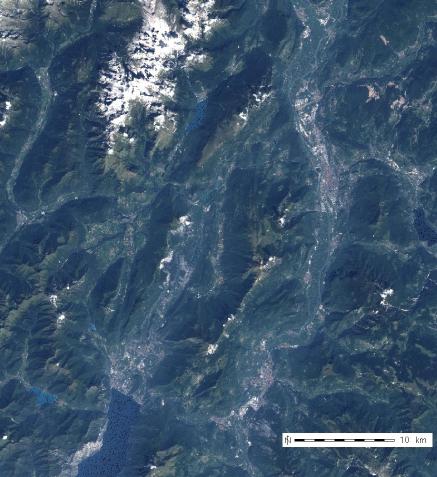
Original subset of Trentino, Italy (LANDSAT TM7, 13 Sep 1999). d.rgb view after i.landsat.rgb application.

Dehazed subset of Trentino, Italy (LANDSAT TM7, 13 Sep 1999). d.rgb view after i.tasscap, i.landsat.dehaze, i.landsat.rgb application.

# preparation of Tasseled Cap "haze" map
i.tasscap -7 band1=tm.10 band2=tm.20 band3=tm.30 band4=tm.40 \
             band5=tm.50 band7=tm.70 out=tasscap

# De-hazing
i.landsat.dehaze band1=tm.10 band2=tm.20 band3=tm.30 band4=tm.40 \
             band5=tm.50 band7=tm.70 tasscap4=tasscap.4 outprefix=dehaze

# color-balanced grey scales:
i.landsat.rgb blue=dehaze.1 green=dehaze.2 red=dehaze.3

# display as RGB composite
d.mon x0
d.rgb blue=dehaze.1 green=dehaze.2 red=dehaze.3


Dehazed subset of Trentino, Italy (LANDSAT TM7, 13 Sep 1999). d.rgb view after i.tasscap, i.landsat.dehaze, i.landsat.rgb application.
Last changed: $Date$
Main index - imagery index - Full index
© 2003-2016 GRASS Development Team