NAME
r.lfp - Calculates the longest flow path for a given outlet point using the r.stream.distance addon.KEYWORDS
hydrology, watershedSYNOPSIS
r.lfp
r.lfp --helpr.lfp input=name output=name coordinates=east,north [--overwrite] [--help] [--verbose] [--quiet] [--ui]
Flags:
- --overwrite
- Allow output files to overwrite existing files
- --help
- Print usage summary
- --verbose
- Verbose module output
- --quiet
- Quiet module output
- --ui
- Force launching GUI dialog
Parameters:
- input=name [required]
- Name of input drainage direction raster map
- output=name [required]
- Name for output longest flow path raster map
- coordinates=east,north [required]
- Coordinates of outlet point
Table of contents
DESCRIPTION
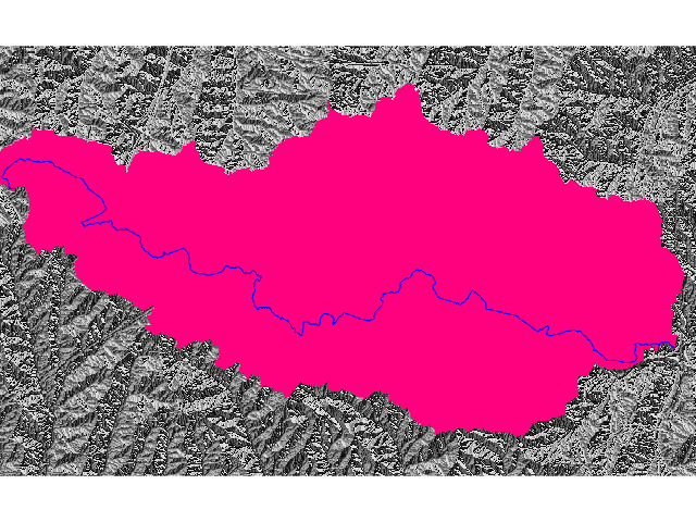
r.lfp calculates the longest flow path for a given outlet point and creates a new raster map with a thin line representing the longest flow path. This module requires the r.stream.distance addon.NOTES
r.lfp creates a longest flow path raster map using a drainage direction raster map and the coordinates of an outlet point. The module internally runs r.stream.distance twice to calculate flow length downstream and upstream raster maps, and combines them to get the longest flow path. An input drainage map can be created using r.watershed or r.stream.extract.EXAMPLES
Workflow example
r.watershed elevation=elev drainage=drain
r.water.outlet input=drain output=basin coordinates=-888857.11,1117788.38
r.lfp input=drain output=lfp coordinates=-888857.11,1117788.38
North Carolina sample dataset example
# set computational region
g.region raster=elevation -p

# calculate drainage directions
r.watershed elevation=elevation drainage=drain_directions

# calculate outlet point related watershed
r.water.outlet input=drain_directions output=basin coordinates=642455,222614

# calculate longest flow path
r.lfp input=drain_directions output=lfp coordinates=642455,222614

SEE ALSO
v.lfp, r.watershed, r.stream.extract, r.stream.distanceHow to calculate the longest flow path in GRASS GIS
AUTHOR
Huidae ChoLast changed: $Date: 2017-03-11 07:31:12 +0100 (Sat, 11 Mar 2017) $
SOURCE CODE
Available at: r.lfp source code (history)
Main index | Raster index | Topics index | Keywords index | Graphical index | Full index
© 2003-2018 GRASS Development Team, GRASS GIS 7.4.1svn Reference Manual