NAME
r.green.biomassfor.theoretical - Estimates potential bioenergy depending on forest increment, forest management and forest treatmentKEYWORDS
raster, biomassSYNOPSIS
r.green.biomassfor.theoretical
r.green.biomassfor.theoretical --helpr.green.biomassfor.theoretical forest=name boundaries=name [energy_tops_hf=float] [forest_column_increment=string] [forest_column_yield_surface=string] [forest_column_management=string] [forest_column_treatment=string] [output_basename=name] [energy_cormometric_vol_hf=float] [energy_tops_cop=float] [--overwrite] [--help] [--verbose] [--quiet] [--ui]
Flags:
- --overwrite
- Allow output files to overwrite existing files
- --help
- Print usage summary
- --verbose
- Verbose module output
- --quiet
- Quiet module output
- --ui
- Force launching GUI dialog
Parameters:
- forest=name [required]
- Name of vector parcel map
- Name of vector parcel map
- boundaries=name [required]
- Name of vector boundaries map (boolean map)
- Name of vector boundaries map (boolean map)
- energy_tops_hf=float
- Energy for tops and branches in high forest in MWh/m³
- Default: 0.49
- forest_column_increment=string
- Vector field of increment
- Default: increment
- forest_column_yield_surface=string
- Vector field of stand surface (ha)
- Default: yield_surface
- forest_column_management=string
- Vector field of forest management (1: high forest, 2:coppice)
- Default: management
- forest_column_treatment=string
- Vector field of forest treatment (1: final felling, 2:thinning)
- Default: treatment
- output_basename=name
- Basename for potential bioenergy (HF,CC and total)
- Default: biomassfor
- energy_cormometric_vol_hf=float
- Energy for the whole tree in high forest (tops, branches and stem) in MWh/m³
- Default: 1.97
- energy_tops_cop=float
- Energy for tops and branches for Coppices in MWh/m³
- Default: 0.55
DESCRIPTION
Compute the theoretical biomass forestry residual potential, based on the annual/periodic forest increment.NOTES
This module permits to evalute the maximum bio-energy from forest residual available in a particular area, on the base of the annual/periodic forest increment. The mandatory data input are a vector file with fields with values of increment, management, treatment, and forest surface. The increment value is expressed in cubic meters, the forest surface in hectares, the management is an integer value that can be 1 for high forest and 2 for coppice, the treatment is an integer field that can be 1 for final felling and 2 for thinning. The energy section contains the calorific parameters that permits to convert the biomass in energy. The output maps are expressed in Mwh.EXAMPLE
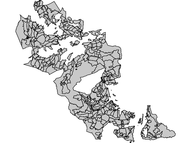
This example shows a typical input vector file with a table composed by fields of increment, forest surface, management and treatment. This example is based on data of Maè Valley, one of the test area of the R.green project
| increment | surface | management | treatment |
| 35.87 | 1500 | 1 | 1 |
| 16.48 | 900 | 1 | 2 |
| 24.82 | 500 | 2 | 1 |
r.green.biomassfor.theoretical --overwrite forest=forest@biomasfor boundaries=Boundary@biomasfor forest_column_increment=increment forest_column_yield_surface=surface forest_column_management=management forest_column_treatment=treatment energy_tops_hs=0.49 energy_cormometric_vol_hf=1.97 energy_tops_cops=0.55 output_basename=mae

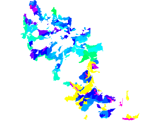
The output map is a standardize energy map with the pixel value equal to the corresponding bioenergy stimated.
REFERENCE
Sacchelli, S., Zambelli, P., Zatelli, P., Ciolli, M., 2013. Biomasfor - an open-source holistic model for the assessment of sustainable forest bioenergy. iFor. Biogeosci. For. 6, 285-293SEE ALSO
r.green.biomassfor.legal, r.green.biomassfor.technical,AUTHORS
Francesco Geri, Pietro Zambelli, Sandro Sacchelli, Marco CiolliLast changed: $Date: 2015-09-14 16:18:58 +0200 (Mon, 14 Sep 2015) $
SOURCE CODE
Available at: r.green.biomassfor.theoretical source code (history)
Main index | Raster index | Topics index | Keywords index | Graphical index | Full index
© 2003-2019 GRASS Development Team, GRASS GIS 7.4.5svn Reference Manual