NAME
v.net.curvedarcs - Draws curved arcs between points (e.g. flows)KEYWORDS
vector, network, flowsSYNOPSIS
Flags:
- -s
- Draw also short line for flow from and to same node
- --overwrite
- Allow output files to overwrite existing files
- --help
- Print usage summary
- --verbose
- Verbose module output
- --quiet
- Quiet module output
- --ui
- Force launching GUI dialog
Parameters:
- input=name [required]
- Point map containing origins and destinations
- Or data source for direct OGR access
- layer=string
- Layer number where to find point categories
- Vector features can have category values in different layers. This number determines which layer to use. When used with direct OGR access this is the layer name.
- Default: 1
- flow_input_file=name [required]
- File containing origins, destinations and flow volumes
- Name of input file
- separator=character
- Separator used in input text file
- Special characters: pipe, comma, space, tab, newline
- Default: pipe
- output=name [required]
- Output map with curved lines
- Name for output vector map
- minimum_offset=float [required]
- minimum offset at furthest point from straight line
- maximum_offset=float [required]
- maximum offset at furthest point from straight line
- vertices=integer
- number of vertices used to draw curved lines
- Default: 30
Table of contents
DESCRIPTION
v.net.curvedarcs is a frontend to v.net and v.segment that creates curved arcs between given start and end points. The user provides a point vector map and a text file (see Notes section) with start and end point categories as well as a flow volume for this link which will be transferred to the attribute table of the curved arcs.The user can determine the nature of the curve with the minimum_offset and maximum_offset parameters. The longest curve's maximum offset from a straight line is equal to the value of maximum_offset in map units. The other curves maximum offset from a straight line is calulated as length(x)/max_length * max_offset. In other words, shorter lines are less curved than longer lines. However, any line's maximum offset is always at least minimum_offset from the straight line.
NOTES
EXAMPLE
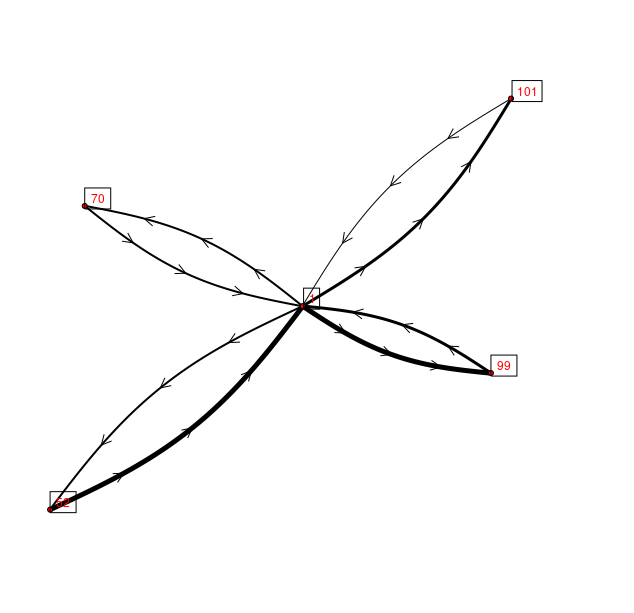
TODOv.extract census_wake2000 cat=1,52,70,99,101 type=centroid out=tmp v.type tmp from=centroid to=point out=points echo >> flows.txt << EOF > from,to,volume > 52,1,100 > 1,52,50 > 70,1,50 > 1,70,50 > 99,1,66 > 1,99,100 > 101,1,25 > 1,101,75 > EOF v.net.curvedarcs in=points flow=flows.txt sep=comma out=flows minoff=0 maxoff=2000 d.vect map=flows display=shape,dir width_column=volume width_scale=0.05 size=10 d.vect map=points display=shape,cat fill_color=red icon=basic/circle label_bcolor=black label_size=12 yref=bottom

The curved arcs with minimum offset = 150 and maximum offset = 2000
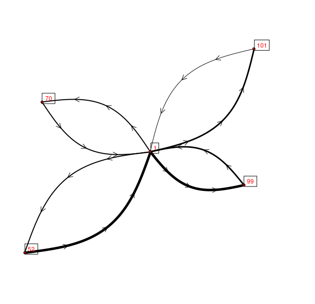
Using different amount of curvature:
v.net.curvedarcs in=points flow=flows.txt sep=comma out=flows minoff=150 maxoff=5000 --o
d.vect map=flows display=shape,dir width_column=volume width_scale=0.05 size=10
d.vect map=points display=shape,cat fill_color=red icon=basic/circle label_bcolor=black label_size=12 yref=bottom

The curved arcs with minimum offset = 0 and maximum offset = 5000
SEE ALSO
v.net, v.segment,AUTHORS
Moritz Lennert, DGES-ULBLast changed: $Date: 2017-05-15 17:17:51 +0200 (Mon, 15 May 2017) $
SOURCE CODE
Available at: v.net.curvedarcs source code (history)
Main index | Vector index | Topics index | Keywords index | Graphical index | Full index
© 2003-2019 GRASS Development Team, GRASS GIS 7.4.5svn Reference Manual