Note: This document is for an older version of GRASS GIS that will be discontinued soon. You should upgrade, and read the current manual page.
Note: This addon document is for an older version of GRASS GIS that will be discontinued soon. You should upgrade your GRASS GIS installation, and read the current addon manual page.
NAME
r.mblend - Blends two rasters of different spatial resolution.KEYWORDS
raster, resolutionSYNOPSIS
Flags:
- -a
- Assign the average difference between the two rasters to the far edge (instead of zero).
- --help
- Print usage summary
- --verbose
- Verbose module output
- --quiet
- Quiet module output
- --ui
- Force launching GUI dialog
Parameters:
- high=string
- High resolution input raster.
- low=string
- Low resolution input raster.
- output=string
- Name of output raster.
- far_edge=value
- Percentage of distance to high resolution raster used to determine far edge. Number between 0 and 100.
- Default: 95
- inter_points=value
- Number of points to use in interpolation. A higher number produces a smoother result but requires a lengthier computation.
- Default: 50
Table of contents
DESCRIPTION
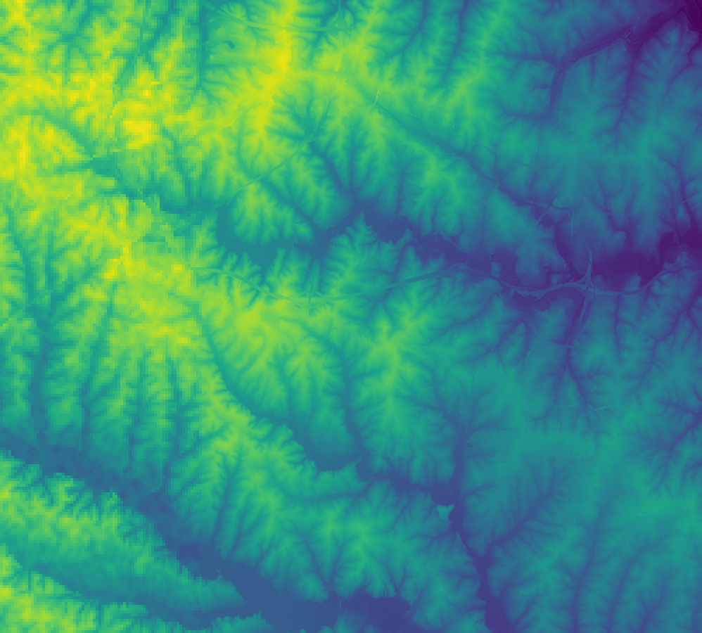
This module implements Mblend, a DEM merging method proposed by Leitão et al. (2016). It deals with cases where a study area is only partially covered by a high resolution DEM, with a coarser DEM available for the remainder (as in the case shown below). r.mblend merges the two DEMs, producing a smooth transition from the high resolution DEM to the low resolution DEM.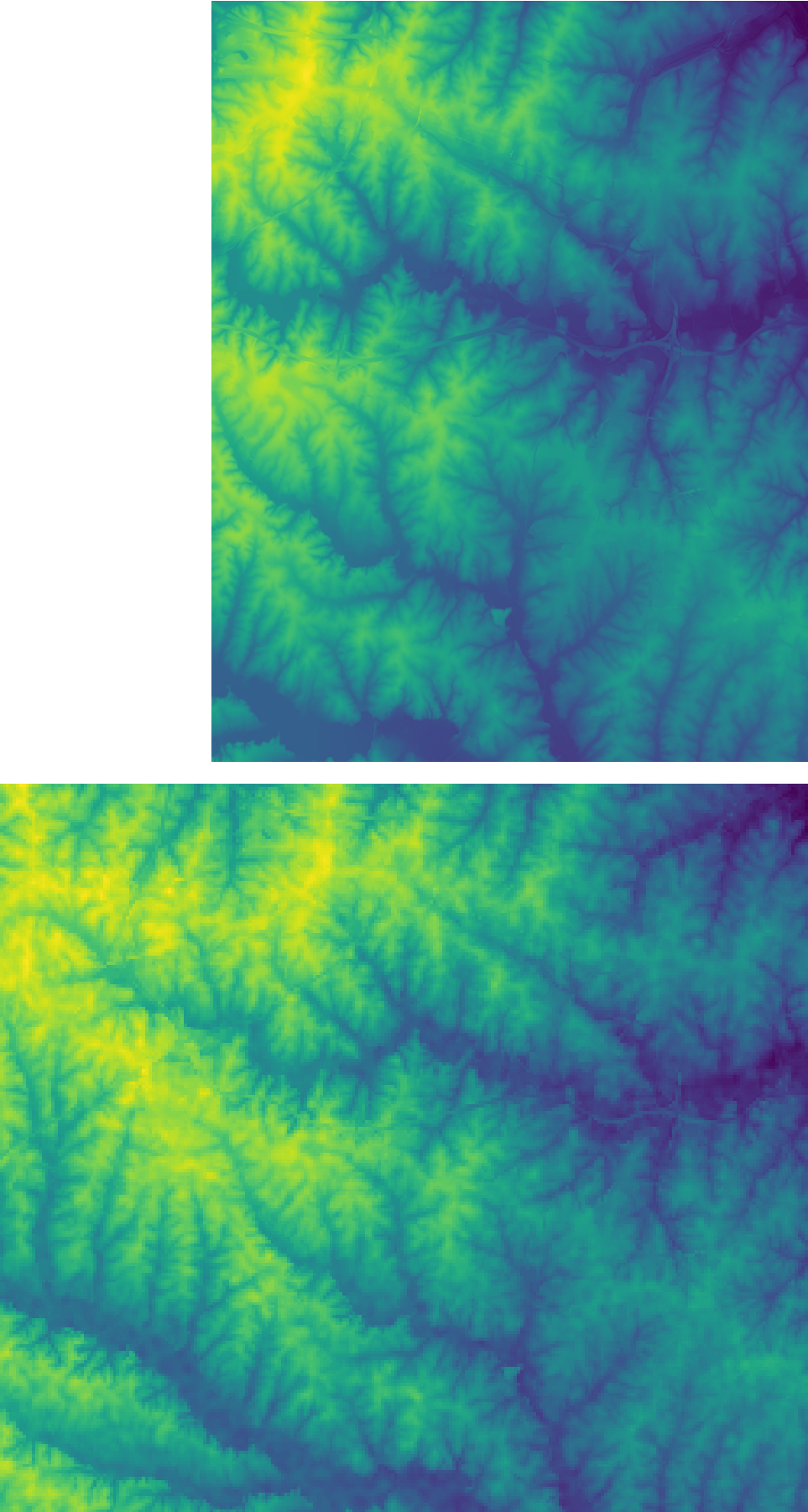
EXAMPLES
Merge the best_dem and other_dem raster maps from the current mapset:r.mblend high=best_dem low=other_dem output=result
r.mblend high=best_dem low=other_dem output=result far_edge=90
REFERENCES
J.P. Leitão, L.M. de Sousa, Towards the optimal fusion of high-resolution Digital Elevation Models for detailed urban flood assessment, Journal of Hydrology, Volume 561, June 2018, Pages 651-661, DOI: 10.1016/j.jhydrol.2018.04.043.L.M. de Sousa, J.P. Leitão, Improvements to DEM Merging with r.mblend. In Proceedings of the 4th International Conference on Geographical Information Systems Theory, Applications and Management - Volume 1: GISTAM, March 2018, pages 42-49. ISBN 978-989-758-294-3 DOI: 10.5220/0006672500420049.
J.P. Leitão, D. Prodanovic, C. Maksimovic, Improving merge methods for grid-based digital elevation models, Computers & Geosciences, Volume 88, March 2016, Pages 115-131, ISSN 0098-3004, DOI: 10.1016/j.cageo.2016.01.001.
SEE ALSO
To report bugs, propose new features or discuss the funcioning of this add-on, visit the project repository at GitHub.AUTHORS
Luís Moreira de SousaISRIC - World Soil Information
João Paulo Leitão
EAWAG: Swiss Federal Institute of Aquatic Science and Technology.
SOURCE CODE
Available at: r.mblend source code (history)
Latest change: Monday Jun 28 07:54:09 2021 in commit: 1cfc0af029a35a5d6c7dae5ca7204d0eb85dbc55
Note: This document is for an older version of GRASS GIS that will be discontinued soon. You should upgrade, and read the current manual page.
Note: This addon document is for an older version of GRASS GIS that will be discontinued soon. You should upgrade your GRASS GIS installation, and read the current addon manual page.
Main index | Raster index | Topics index | Keywords index | Graphical index | Full index
© 2003-2023 GRASS Development Team, GRASS GIS 7.8.9dev Reference Manual