Note: This document is for an older version of GRASS GIS that has been discontinued. You should upgrade, and read the current manual page.
NAME
m.measure - Measures the lengths and areas of features.KEYWORDS
miscellaneous, measurement, distance, areaSYNOPSIS
m.measure
m.measure --helpm.measure [-g] coordinates=east,north[,east,north,...] [units=string] [--help] [--verbose] [--quiet] [--ui]
Flags:
- -g
- Shell script style
- --help
- Print usage summary
- --verbose
- Verbose module output
- --quiet
- Quiet module output
- --ui
- Force launching GUI dialog
Parameters:
- coordinates=east,north[,east,north,...] [required]
- Coordinates
- units=string
- Units
- Default: location map units
- Options: miles, feet, meters, kilometers, acres, hectares
Table of contents
DESCRIPTION
m.measure provides the user with a way to measure the lengths and areas of lines and polygons. Areas can be stated in acres, hectares, square miles, square feet, square meters and square kilometers.EXAMPLES
Distance example in a latitude-longitude location (on great circle, i.e. an orthodrome):Bonn_DE="7.09549,50.73438" Philadelphia_US="-75.16379,39.95233" m.measure coordinates="$Bonn_DE,$Philadelphia_US" units=kilometers Length: 6217.916452 kilometers
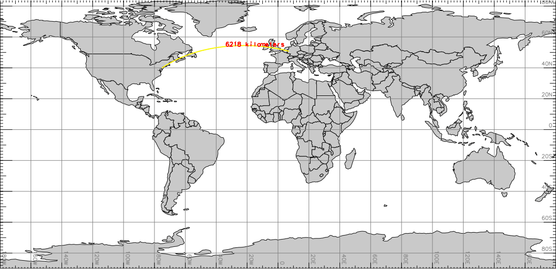
Visualization (with d.geodesic) of m.measure distance example
As an example for the North Carolina sample dataset, here four points describing a square of 1000m side length:
m.measure units=meters \
  coordinates=922000,2106000,923000,2106000,923000,2107000,922000,2107000
Length:  3000.000000 meters
Area:    1000000.000000 square meters

# script style output:
m.measure -g units=hectares \
  coordinates=922000,2106000,923000,2106000,923000,2107000,922000,2107000
units=meters,square meters
length=3000.000000
area=1000000.000000
SEE ALSO
d.geodesicAUTHORS
Glynn ClementsSome updates by Martin Landa, CTU in Prague, Czech Republic
Derived from d.measure by James Westervelt, Michael Shapiro, U.S. Army Construction Engineering Research Laboratory
SOURCE CODE
Available at: m.measure source code (history)
Latest change: Sunday Dec 15 22:03:02 2019 in commit: 2c42a0b086bbb943b6c58d051fa5948041b8b219
Main index | Miscellaneous index | Topics index | Keywords index | Graphical index | Full index
© 2003-2023 GRASS Development Team, GRASS GIS 7.8.9dev Reference Manual