NAME
r.learn.ml2 - GRASS GIS Reference ManualTable of contents
DESCRIPTION
r.learn.ml2 represents a front-end to the scikit learn python package. The module enables scikit-learn classification and regression models to be applied to GRASS GIS rasters that are stored as part of an imagery group group or specified as individual maps in the optional raster parameter.
The training component of the machine learning workflow is performed using the r.learn.train module. This module uses training data consisting of labelled pixels in a GRASS GIS raster map, or a GRASS GIS vector containing points, and develops a machine learning model on the rasters within a GRASS imagery group. This model needs to be saved to a file and can be automatically compressed if the .gz file extension is used.
After a model is training, the r.learn.predict module needs to be called, which will retrieve the saved and pre-fitted model and apply it to a GRASS GIS imagery group.
NOTES
r.learn.ml2 uses the "scikit-learn" machine learning python package (version ≥ 0.20) along with the "pandas" package. These packages need to be installed within your GRASS GIS Python environment. For Linux users, these packages should be available through the linux package manager. For MS-Windows users using a 64 bit GRASS, the easiest way of installing the packages is by using the precompiled binaries from Christoph Gohlke and by using the OSGeo4W installation method of GRASS, where the python setuptools can also be installed. You can then use 'easy_install pip' to install the pip package manager. Then, you can download the NumPy+MKL and scikit-learn .whl files.
EXAMPLE
Here we are going to use the GRASS GIS sample North Carolina data set as a basis to perform a landsat classification. We are going to classify a Landsat 7 scene from 2000, using training information from an older (1996) land cover dataset.
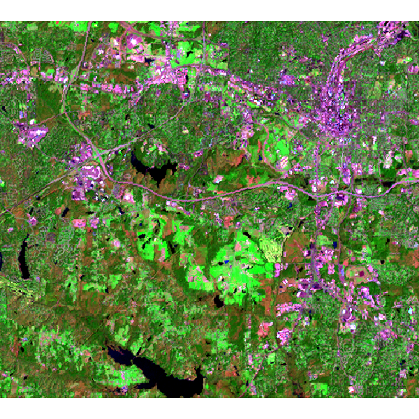
Landsat 7 (2000) bands 7,4,2 color composite example:
Note that this example must be run in the "landsat" mapset of the North Carolina sample data set location.
First, we are going to generate some training pixels from an older (1996) land cover classification:
g.region raster=landclass96 -p
r.random input=landclass96 npoints=1000 raster=training_pixels
Then we can use these training pixels to perform a classification on the more recently obtained landsat 7 image:
# train a random forest classification model using r.learn.train
r.learn.train group=lsat7_2000 training_map=training_pixels \
	model_name=RandomForestClassifier n_estimators=500 save_model=rf_model.gz

# perform prediction using r.learn.predict
r.learn.predict group=lsat7_2000 load_model=rf_model.gz output=rf_classification

# check raster categories - they are automatically applied to the classification output
r.category rf_classification

# copy color scheme from landclass training map to result
r.colors rf_classification raster=training_pixels
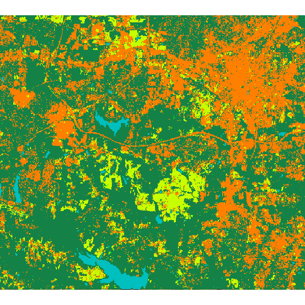
Random forest classification result:
SEE ALSO
r.learn.train, r.learn.predictREFERENCES
Scikit-learn: Machine Learning in Python, Pedregosa et al., JMLR 12, pp. 2825-2830, 2011.
AUTHOR
Steven PawleySOURCE CODE
Available at: r.learn.ml2 source code (history)
Latest change: Monday Jun 24 08:05:14 2024 in commit: 62e7974ae682692e46f54dbfce83a46ac7c1acb8
Note: This document is for an older version of GRASS GIS that will be discontinued soon. You should upgrade, and read the current manual page.
Main index | Raster index | Topics index | Keywords index | Graphical index | Full index
© 2003-2023 GRASS Development Team, GRASS GIS 8.2.2dev Reference Manual