g.gui.photo2image
DESCRIPTION
This module is based on g.gui.gcp, the GCP manager of GRASS. It is part of i.ortho.photo suite.
The aim of this module is to give absolute location values to the fiducial points present (in number of 4 or 8) in a scanned aerial photo.
This is necessary as (manual) scanning introduces distortions, rotations and also may not be limited to scan the boundary of the photo itself. It is thus necessary to give to each fiducial the exact coordinates in mm as given by the aerial photographic instrument design, which is unique per camera.
This module requires you to have made a group with your aerial photo (i.group), a camera description file (i.ortho.target) and use them to launch the module. Additional requirements are the order of rectification (1 if no of Fiducials is 4, 2 if no of Fiducials is 8) and an extension file (if not given, defaults to \filename_ip2i_out)
An example for project imagery60:
g.gui.photo2image group=aerial@PERMANENT raster=gs13.1@PERMANENT camera=gscamera order=2 extension=try --o
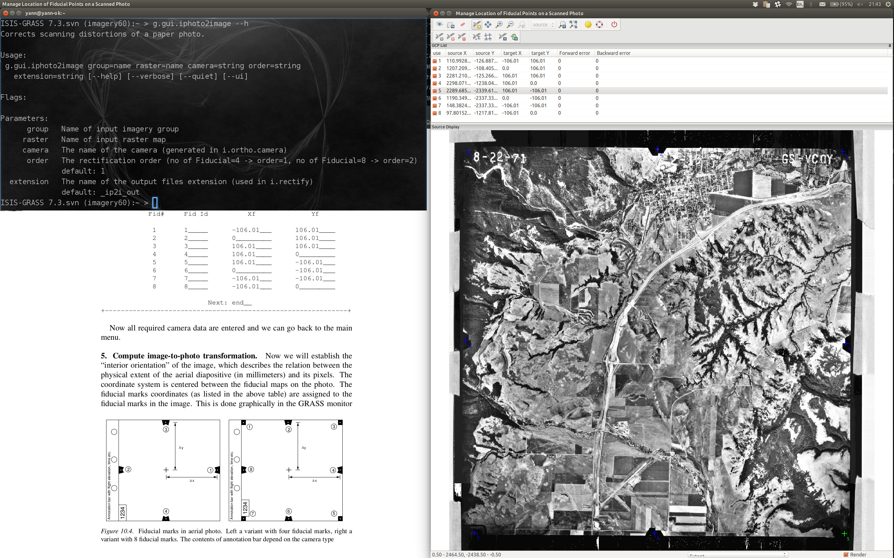
Figure: Screenshot of g.gui.photo2image
SEE ALSO
i.ortho.photo, i.group, i.ortho.camera, i.ortho.target, i.rectify, m.transform, v.rectify
See also video tutorials on GRASS Wiki.
AUTHORS
Markus Metz
Based on the Georectifier (GRASS 6.4.0) by Michael Barton
Martin Landa, Czech Technical University in Prague, Czech Republic
SOURCE CODE
Available at: g.gui.photo2image source code
(history)
Latest change: Wednesday Jan 28 08:16:26 2026 in commit 0a9db34