Note: This document is for an older version of GRASS GIS that has been discontinued. You should upgrade, and read the current manual page.

NAME
i.histo.match - Calculate histogram matching of several images.KEYWORDS
imagery, histogram matchingSYNOPSIS
i.histo.match
i.histo.match --helpi.histo.match input=name[,name,...] [suffix=string] [output=name] [database=name] [max=integer] [--overwrite] [--help] [--verbose] [--quiet] [--ui]
Flags:
- --overwrite
- Allow output files to overwrite existing files
- --help
- Print usage summary
- --verbose
- Verbose module output
- --quiet
- Quiet module output
- --ui
- Force launching GUI dialog
Parameters:
- input=name[,name,...] [required]
- Name of raster maps to be analyzed
- suffix=string
- Suffix for output maps
- Default: match
- output=name
- Name for mosaic output map
- database=name
- Name of database
- Default: $GISDBASE/$LOCATION_NAME/$MAPSET/histo.db
- max=integer
- Number of the maximum value for raster maps
- Default: 255
Table of contents
DESCRIPTION
i.histo.match performs histogram matching on the given input images.NOTES
The histogram matching method is based on the method Cumulative Distribution Function (CDF) of two or more histograms. Each value of original CDF is compared with the target histogram in order to obtain the target CDF value closest to the original value.EXAMPLE
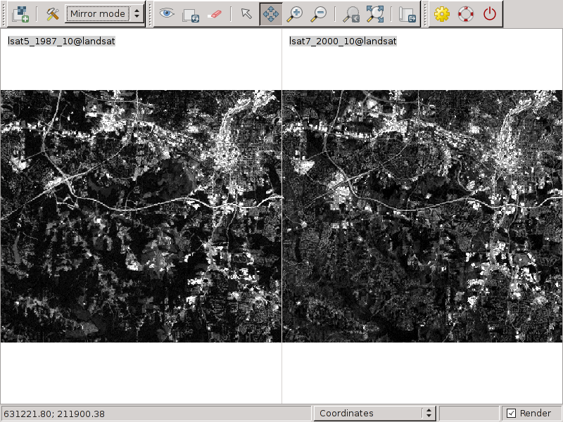
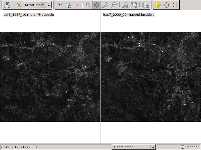
This example is based the North Carolina GRASS sample data set, [complete GRASS location].# create the output with histogram matching i.histo.match input=lsat5_1987_10,lsat7_2000_10 # set grey color to the new maps r.colors map=lsat5_1987_10.match color=grey r.colors map=lsat7_2000_10.match color=grey # visualize and compare the results
Original data:

Matched data:

SEE ALSO
i.ortho.photo, i.rectifyAUTHORS
Luca Delucchi, Fondazione E. Mach (Italy)based on original PERL code was developed by: Laura Zampa (2004), student of Dipartimento di Informatica e Telecomunicazioni, Facolta' di Ingegneria, University of Trento and ITC-irst, Trento (Italy)
SOURCE CODE
Available at: i.histo.match source code (history)
Latest change: Monday Jun 28 07:54:09 2021 in commit: 1cfc0af029a35a5d6c7dae5ca7204d0eb85dbc55
Main index | Imagery index | Topics index | Keywords index | Graphical index | Full index
© 2003-2023 GRASS Development Team, GRASS GIS 7.8.9dev Reference Manual