GIS Library - Coordinate scanning functions. More...
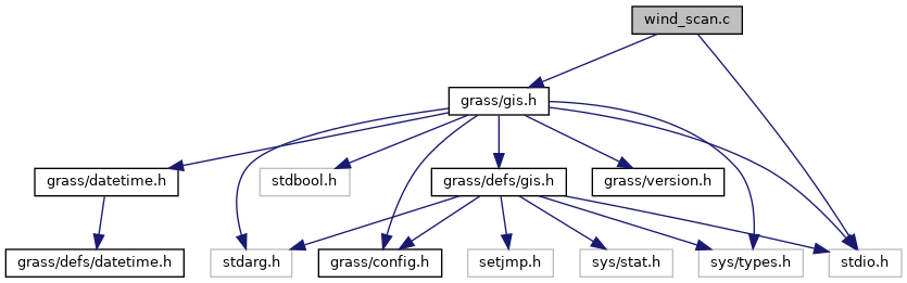
Go to the source code of this file.
Functions | |
| int | G_scan_northing (const char *buf, double *northing, int projection) |
| ASCII northing to double. | |
| int | G_scan_easting (const char *buf, double *easting, int projection) |
| ASCII easting to double. | |
| int | G_scan_resolution (const char *buf, double *res, int projection) |
| ASCII resolution to double. | |
Detailed Description
GIS Library - Coordinate scanning functions.
SPDX-FileCopyrightText: 2001-2009, 2011 GRASS Development Team SPDX-License-Identifier: GPL-2.0-or-later
Definition in file wind_scan.c.
Function Documentation
◆ G_scan_easting()
ASCII easting to double.
Converts the ASCII "easting" coordinate string in buf to its double representation (into easting).
Supported projection codes (see gis.h):
- PROJECTION_XY
- PROJECTION_UTM
- PROJECTION_LL
- PROJECTION_OTHER
- Parameters
-
buf buffer containing string easting [out] easting easting projection projection code
- Returns
- 0 on error
- 1 on success
Definition at line 67 of file wind_scan.c.
References G_lon_scan(), and PROJECTION_LL.
Referenced by G__read_Cell_head_array(), and Vect_read_ascii().
◆ G_scan_northing()
ASCII northing to double.
Converts the ASCII "northing" coordinate string in buf to its double representation (into northing).
Supported projection codes (see gis.h):
- PROJECTION_XY
- PROJECTION_UTM
- PROJECTION_LL
- PROJECTION_OTHER
- Parameters
-
buf buffer hold string northing [out] northing northing projection projection code
- Returns
- 0 on error
- 1 on success
Definition at line 36 of file wind_scan.c.
References G_lat_scan(), and PROJECTION_LL.
Referenced by G__read_Cell_head_array(), and Vect_read_ascii().
◆ G_scan_resolution()
ASCII resolution to double.
Converts the ASCII "resolution" string in buf to its double representation (into resolution).
Supported projection codes (see gis.h):
- PROJECTION_XY
- PROJECTION_UTM
- PROJECTION_LL
- PROJECTION_OTHER
- Parameters
-
buf buffer containing string resolution [out] res resolution value projection projection code
- Returns
- 0 on error
- 1 on success
Definition at line 98 of file wind_scan.c.
References G_llres_scan(), and PROJECTION_LL.
Referenced by G__read_Cell_head_array().