d.rast
Displays user-specified raster map in the active graphics frame.
d.rast [-ni] map=name [values=value[-value] [,value[-value],...]] [bgcolor=color] [--verbose] [--quiet] [--qq] [--ui]
Example:
d.rast map=name
grass.tools.Tools.d_rast(map, values=None, bgcolor="white", flags=None, verbose=None, quiet=None, superquiet=None)
Example:
tools = Tools()
tools.d_rast(map="name")
This grass.tools API is experimental in version 8.5 and expected to be stable in version 8.6.
grass.script.run_command("d.rast", map, values=None, bgcolor="white", flags=None, verbose=None, quiet=None, superquiet=None)
Example:
gs.run_command("d.rast", map="name")
Parameters
map=name [required]
Name of raster map to be displayed
values=value[-value] [,value[-value],...]
List of categories or values to be displayed
bgcolor=color
Background color (for null)
Either a standard color name or R:G:B triplet
Default: white
-n
Make null cells opaque
-i
Invert value list
--help
Print usage summary
--verbose
Verbose module output
--quiet
Quiet module output
--qq
Very quiet module output
--ui
Force launching GUI dialog
map : str | np.ndarray, required
Name of raster map to be displayed
Used as: input, raster, name
values : str | list[str], optional
List of categories or values to be displayed
Used as: value[-value]
bgcolor : str, optional
Background color (for null)
Either a standard color name or R:G:B triplet
Used as: input, color, color
Default: white
flags : str, optional
Allowed values: n, i
n
Make null cells opaque
i
Invert value list
verbose : bool, optional
Verbose module output
Default: None
quiet : bool, optional
Quiet module output
Default: None
superquiet : bool, optional
Very quiet module output
Default: None
Returns:
result : grass.tools.support.ToolResult | None
If the tool produces text as standard output, a ToolResult object will be returned. Otherwise, None will be returned.
Raises:
grass.tools.ToolError: When the tool ended with an error.
map : str, required
Name of raster map to be displayed
Used as: input, raster, name
values : str | list[str], optional
List of categories or values to be displayed
Used as: value[-value]
bgcolor : str, optional
Background color (for null)
Either a standard color name or R:G:B triplet
Used as: input, color, color
Default: white
flags : str, optional
Allowed values: n, i
n
Make null cells opaque
i
Invert value list
verbose : bool, optional
Verbose module output
Default: None
quiet : bool, optional
Quiet module output
Default: None
superquiet : bool, optional
Very quiet module output
Default: None
DESCRIPTION
d.rast displays the specified raster map in the active display frame on the graphics monitor.
EXAMPLE
Display raster map "elevation":
d.rast map=elevation
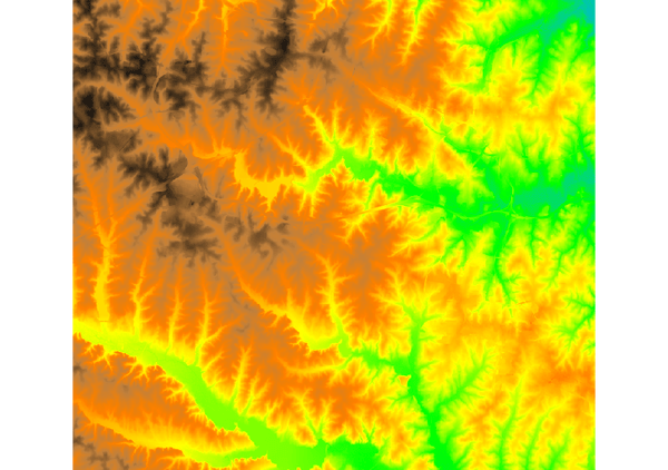
Figure: elevation raster map visualization
Display raster map "elevation" but only the raster cells with values between 75 and 80 meters:
d.rast map=elevation values=75-80
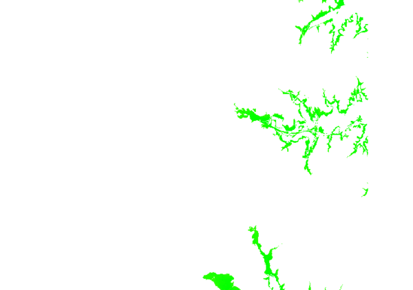
Figure: elevation raster map showing values between 75 and 80 meters
Display raster map "landuse96_28m" but only categories 1 and 2:
d.rast landuse96_28m values=1,2
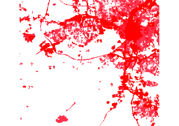
Figure: landuse raster map showing categories 1 and 2
SEE ALSO
d.rast.arrow, d.rast.num, d.rast.leg, d.legend, d.mon, d.erase, d.vect
AUTHOR
James Westervelt, U.S. Army Construction Engineering Research Laboratory
SOURCE CODE
Available at: d.rast source code
(history)
Latest change: Wednesday Feb 12 23:02:46 2025 in commit 9c11460