r.centroids
Creates vector map of centroids from raster of "clumps".
r.centroids input=name output=name [--overwrite] [--verbose] [--quiet] [--qq] [--ui]
Example:
r.centroids input=name output=name
grass.tools.Tools.r_centroids(input, output, overwrite=None, verbose=None, quiet=None, superquiet=None)
Example:
tools = Tools()
tools.r_centroids(input="name", output="name")
This grass.tools API is experimental in version 8.5 and expected to be stable in version 8.6.
grass.script.run_command("r.centroids", input, output, overwrite=None, verbose=None, quiet=None, superquiet=None)
Example:
gs.run_command("r.centroids", input="name", output="name")
Parameters
input=name [required]
Raster map of clumps, clusters of same-valued pixels
output=name [required]
Name for output vector map
--overwrite
Allow output files to overwrite existing files
--help
Print usage summary
--verbose
Verbose module output
--quiet
Quiet module output
--qq
Very quiet module output
--ui
Force launching GUI dialog
input : str | np.ndarray, required
Raster map of clumps, clusters of same-valued pixels
Used as: input, raster, name
output : str, required
Name for output vector map
Used as: output, vector, name
overwrite : bool, optional
Allow output files to overwrite existing files
Default: None
verbose : bool, optional
Verbose module output
Default: None
quiet : bool, optional
Quiet module output
Default: None
superquiet : bool, optional
Very quiet module output
Default: None
Returns:
result : grass.tools.support.ToolResult | None
If the tool produces text as standard output, a ToolResult object will be returned. Otherwise, None will be returned.
Raises:
grass.tools.ToolError: When the tool ended with an error.
input : str, required
Raster map of clumps, clusters of same-valued pixels
Used as: input, raster, name
output : str, required
Name for output vector map
Used as: output, vector, name
overwrite : bool, optional
Allow output files to overwrite existing files
Default: None
verbose : bool, optional
Verbose module output
Default: None
quiet : bool, optional
Quiet module output
Default: None
superquiet : bool, optional
Very quiet module output
Default: None
DESCRIPTION
r.centroids is a wrapper function for r.volume that computes the center point of raster clumps of data (neighboring, same-valued pixels). The centroids will always fall within the clump so they may not be the true, mathematical centroid. The centroids will always fall at the center of a pixel.
r.centroids requires an input raster containing clumps of data such as the output of r.clump.
EXAMPLES
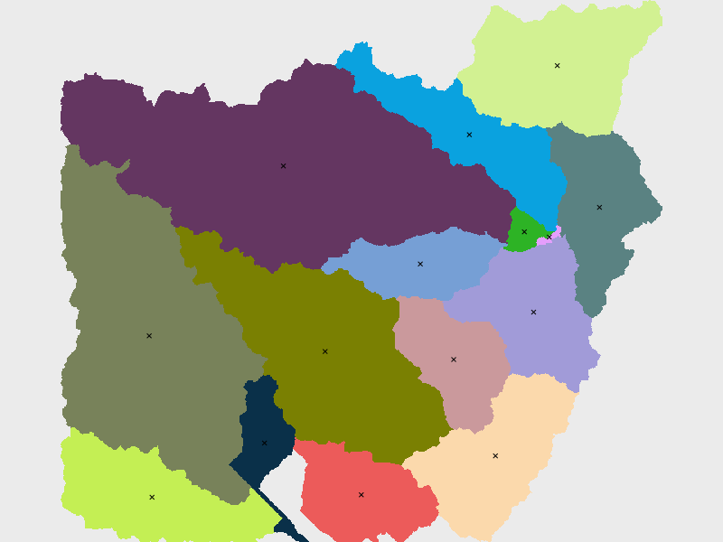
Find the centroids of the basins map (North Carolina sample dataset). First, set computational area.
g.region raster=basin_50K
Then, compute the centroids.
r.centroids input=basin_50K output=centroids50K
SEE ALSO
AUTHOR
Caitlin Haedrich, Center for Geospatial Analytics, North Carolina State University, January, 2021.
SOURCE CODE
Available at: r.centroids source code
(history)
Latest change: Wednesday Jul 15 17:22:10 2026 in commit 6a3492d